Scotland

This particular blog series chronicles our 11 day family trip to Scotland in the Summer of 2011. Each of our children has been told that they may have an international trip as a high school graduation present to broaden their horizons and deepen their interests. Provided the country they pick is not on the list of places the State Departmet feels Americans should avoid, they can pick just about anywhere that interests them. Our oldest son Will, true to his Scottish heritage, and his interest in all things Scottish chose to visit the "motherland." While this blog is not from his perspective, it is written with an eye towards "traveling as a family," observations about culture and history, as well as simply chronically our experiences as they happen and as I interpret them.

Saturday, May 16, 2015

The Old Man and the Billy Goats Gruff

Random sheep near Old Man of Storr, Isle of Skye--sporting summer haircut.
We wake up early the next day despite efforts to sleep in.  Fueling ourselves with an ample breakfast we head back out down the main road toward The Old Man of Storr, the vertical rock formation which is clearly visible from the road  between Portree and Staffin.  Bear in mind that National Geographic has listed Skye as one of the top 10 islands in the world for it's natural wonders. The geology of the island is unique and rugged.  That said, I planned this portion of the trip to include hiking and this hike ranks as one of the best.  The website below outlines every possible hike and walk you might want to attempt while visiting Skye.

http://www.walkhighlands.co.uk/skye/trotternish.shtml

While the weather is a bit uncooperative (we fully expected this) we have packed rain gear and sturdy shoes so the weather would not be a deterrent.

The car park on the side of the road is already half full when we begin our hike at the edge of a very dense forest.

Trail head, Old Man of Storr, Isle of Skye.
Although this forest is clearly not old growth, it is managed by the Scottish Forestry Commission, it has that feel of a primeval wood.  It is so thickly planted that light barely filters in at all.  What immediately comes to mind are fairy tales involving children and maidens (think Snow White) who get lost in the deep dark woods.  If we wandered from the trail here it would be easy to quickly become disoriented.    The moss and the tips of the pine trees are such a bright shade a green they almost seem electrified and what little light filters through is so fine and ethereal.

Forest near the base of The Old Man of Storr, Isle of Skye


It is hard to imagine after having driven up to the Orkney Islands and seeing the skinned bald landscape, that historically much of Scotland was covered with forests.  During the 17th and 18th century what forests were left were heavily exploited for timber and charcoal production. While Scotland is environmentally stunning today at first glance, bear in mind that much of the landscape has been used and heavily exploited.  Today only about 17% of Scotland is forested (up from a low of 5% in 1900) but the government plans to expand this to 25% by the 21st century.  The Scottish Natural Heritage website has more information about Scotland's woodland areas.   (I have since learned that much of the forest at the base of The Old Man of Storr has been clear cut.)

http://www.snh.gov.uk/land-and-sea/managing-the-land/forestry-and-woodlands/history/

Hiking to The Old Man of Storr, Isle of Skye
The climb through the forest was steep but we eventually break out into the open.  We pass through a gate (sheep are grazed up here as it is common land) and the uphill trajectory intensifies.  Mist still clings to the cliffs up ahead of us but every now and then when the mist clears we see The Old Man.

The Old Man of Storr, Isle of Skye
Sheep browse on the hillside and paid us no mind until I heard the deep guttural bleat of a ram.  My first thought was "that is not a steer"  (not knowing what a castrated male sheep is called.)  My next vision was one of us being head butted all the way down the steep hillside.  I look to the left and there is a young ram charging downhill straight towards us.  I shoo the boys up to a steeper level so the ram won't have much momentum built up when it charges us!  Looking back I see my husband 20-30 feet behind us on a level area that is very vulnerable.  My younger son looks over to the hillside on the right and says "there are two of them!"  I'm thinking "great now we have to out run two of them!"  Then I remember how barnyard interactions involving two "intact" male farm animals from the same species usually plays out.  Sure enough, the ram  on the left completely ignored us evidently having had his ire provoked by the the ram on the other hillside.  We leave them bleating and chasing each other over hill and dale to sort it all out.  The boys (mine, not the rams) thought all this was extremely entertaining.

The base of The Old Man of Storr, Isle of Skye.
The rest of the climb to The Old Man is very steep and I send Sam and the boys on ahead.  I am perfectly satisfied with the view I have and keep taking pictures with my phone, each view featuring a different mist-draped view of the rock.  It truly stands sentinel-like in the mist no less sacred than the stones at Stenness or The Ring of Brodgar.  This is one stone I cannot put in my pocket and take home as a memento (see Skara Brae blog post)


One the way back down the trail we meet a cross section of the global community who have come to make the pilgrimage to view The Old Man. -- Australians, Germans, Scandinavians, Italians, a group of uniformed English schoolboys and an occasional Scot.  By the time we reach the forest it is raining harder and upon arriving at the car park we are for the most part drenched and I learn the difference between "waterproof" and "water resistant." We extract ourselves from the full parking lot and rather than heading to Portree to find lunch we head back to our hotel for some dry clothes.  I never thought much of the heated towel bars in UK hotels but now discover they are the perfect place to park a pair of sodden running shoes, wet clothes and a wet rain coat.  We will plan our next adventure of the day over lunch.


P.S.  A castrated male sheep is called a "wether."


Wednesday, May 6, 2015

A Room with a View

Staffin Bay view from The Flodigarry Hotel, Isle of Skye
Reaching Isle of Skye we pass through the narrow streets of Portree (pronounced "Por-try") it's lanes lined with B&B's and hostels.  By now we are delirious and so ready to get to our destination.  Some 20 miles down the road lies our lodging, Flodigary Country House Hotel, located outside Staffin. We encounter sheep in the road and they don't get in big hurry to move out of our way.  They stand in the middle of the road eyeing us and vigorously chewing their cud before deciding to move on. They did not flinch when Sam lightly tapped on the car horn.

Google maps couldn't seem to make up it's mind where this place was located at one point listing it as a P.O. Box in Portree and a Gaelic road name near Staffin which turned out to clearly not be our hotel.  There is one road in and out of Staffin and I decide as chief navigator that if we simply keep driving and surely there will be a road sign.  The car climbs higher and higher into the jagged green terrain.  Both boys are bounding off the windows in the back seat and Sam is having serious questions about the accommodations I have booked.  There are cliffs and buttes (I'm sure the locals don't call them that.) to the left and amazing coastline to the right and soon I recognize the cliffs from the pictures of the hotel on the website and then there is a sign.  We turn down a steep switchbacked lane with some of the greenest vegetation I have ever seen and voila  -- The Flodigary Hotel.  (Please note that the hotel has changed hands since our visit but appears to have maintained it's excellent rating.)

http://www.tripadvisor.com/Hotel_Review-g551889-d246389-Reviews-The_Flodigarry_Hotel-Staffin_Isle_of_Skye_The_Hebrides_Scotland.html

The Flodigarry Hotel, Staffin, Isle of Skye

Emerging from the car park of the Hotel we are met with the most astonishing view of water and a small island and the freshest air in Scotland.  Now I know what I am paying for and it is THAT view.  Selecting our accomodations back in the states I booked all levels - clean spartan and very basic, midpriced, and a splurge.  Flodigarry is the splurge.  The decompression from the long drive was almost instantaneous.  We stumble into the lobby to inquire about our rooms gratefully accepting the complimentary wine and scotch on a nearby sideboard.  Our 18 year old decides to sample the scotch and ends up spluttering and coughing to the great amusement of his younger brother.

Sam and I have a room up front with a view and the boys have a room more towards the back of the property.  We finish our wine sitting in the chairs positioned in front of our window and ogle the view.  There is a pub/restaurant attached to the hotel and I am eager to sample the local fare and order a large bowl of seafood chowder which I devour.

A light rain is falling after dinner but Sam and I turn the boys loose, put on our raincoats and walk down the road to inspect the terrain and fill our lungs with the fresh air.  It sounds so horrifically cliche but you do half expect to run into the characters from Lord of the Rings, the terrain has that "je ne sais quois" that kindles the imagination.  No wonder Scotland is so rich in folklore and notions of mythological characters.

Near Old Man of Storr, Isle of Skye


The sheep that would not run from us when we were behind the wheel of a car (and could presumably run over them) now flee from us and look back warily even though we are much more harmless on foot.  We walk back to the hotel pub and linger on the terrace with a glass of wine and looking out over the bay until we can hardly hold our eyes open.  We crawl into our very comfortable bed.  Tomorrow we will hike to the Old Man of Storr.

Sheep near Staffin, Isle of Skye


Thursday, March 5, 2015

Journey to Skye

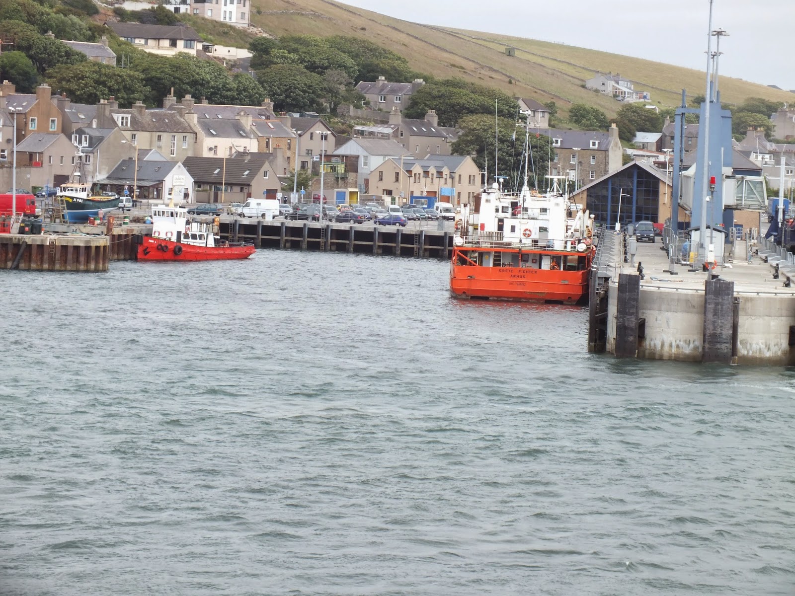
Harbor, Stromness, Orkney Islands
 
Our ferry leaves Stromness at 11:00 this morning.  Our hostess feeds us a hearty breakfast and bids us farewell.  There is just enough time in Stromness to poke around town for a bit before our ferry leaves.  Today is more foggy and overcast and the sea is a bit choppy.  Boarding the ferry I find a table with comfy chairs in the bar area on the left so I can have a good view of The Old man of Hoy. The ship pulls out of the harbor rotates itself 180 degrees. (I'm guessing so that cars don't have to back out of the ferry upon docking at Scrabster.)  So much for my carefully laid plains for good viewing.  I keep our seats anyway and can see at least for a little while the northern coastline of Stromness.

Dwelling outside Stromness, Orkney Islands

I spend most of the time on the ferry catching up on my journal entries for the next 1 1/2 hours.  Our drive today is a long one and I hope Sam is up for it.  We should reach Isle of Skye by 6:30.  The journey will involve retracing some of our steps plus some new routes across Scotland and onward to Sky.  The hotel I have book will be the most luxurious of the accomodation yet on the trip.  I am looking forward to this!

Catching up on travel journal entries.  


Happy husband and still jet lagged son.


 Crisscrossing northern Scotland we traverse back across the eerie moonscape with the abandoned crofts and the wind turbines. It all doesn't seem so lonely and foreboding as it did three days ago on our way up to the Orkney's.  We skim down the coastal road on the eastern side of Scotland and find that it is just as productive to retrace our steps as the perspective is different coming from the opposite direction.  Castles and landmarks that could not be seen on the journey up can now be seen on the way back down.  We could have tried to get to Skye from the western side.  As the crow flies it looks to be about the same distance to access the Western Isles but we would have had to zigzag our way around the many lochs as most of them had no bridges plus there are no major roadways similar to the A9.  We decide to save the western side of the upper Highlands for another trip.

We stop in a little town called Helmsdale (the kids called it Helms Deep) for what was planned to be a quick light inexpensive lunch.  Finding a very well appointed pub called The Red Lobster we are asked to take a seat on some nice barrister sofas.

The Red Lobster, Helmsdale, Scotland.
The bar is overflowing with the most profuse selection of Scotch I've seen yet on the trip.  We are given menus and we wonder if we will be expected to eat our soup seated at the barrister sofas in the bar area.  Soon our waitress returns and says our table is ready and escorts us towards the back where we have an entire room to ourselves.  Our food arrives and we are not disappointed.  Sam and I have Scotch broth while Will sticks with his usual French onion and Thomas samples potato leek.  The cheese board includes an assortment of local cheeses with various chutneys and oat cakes.  All in all the meal was a little more than we planned to spend but what a serendipitous find!  Travel should, of course, not consist of every movement planned down to the last detail.  While we didn't stay long in Helmsdale I mentally bookmark the town for future trips.  I heard the fishing in the area is excellent.

http://www.visitscotland.com/en-us/info/towns-villages/helmsdale-p236041

Back in the car, we head toward Inverness.  Rather than going back through Inverness we decide to navigate through Dingwall which will save us time as Inverness has many roundabouts to negotiate.  Reaching Kyle of Lochalsch (which is basically the gateway to the Isle of Skye) we can see how magnificent Skye is going to be.  The Cuillen Hills are in front of us (mountains would be a more apt description).  The terrain is straight up and down and very very green and the views, well--I won't even try.


Wednesday, November 19, 2014

Goodbye For Now


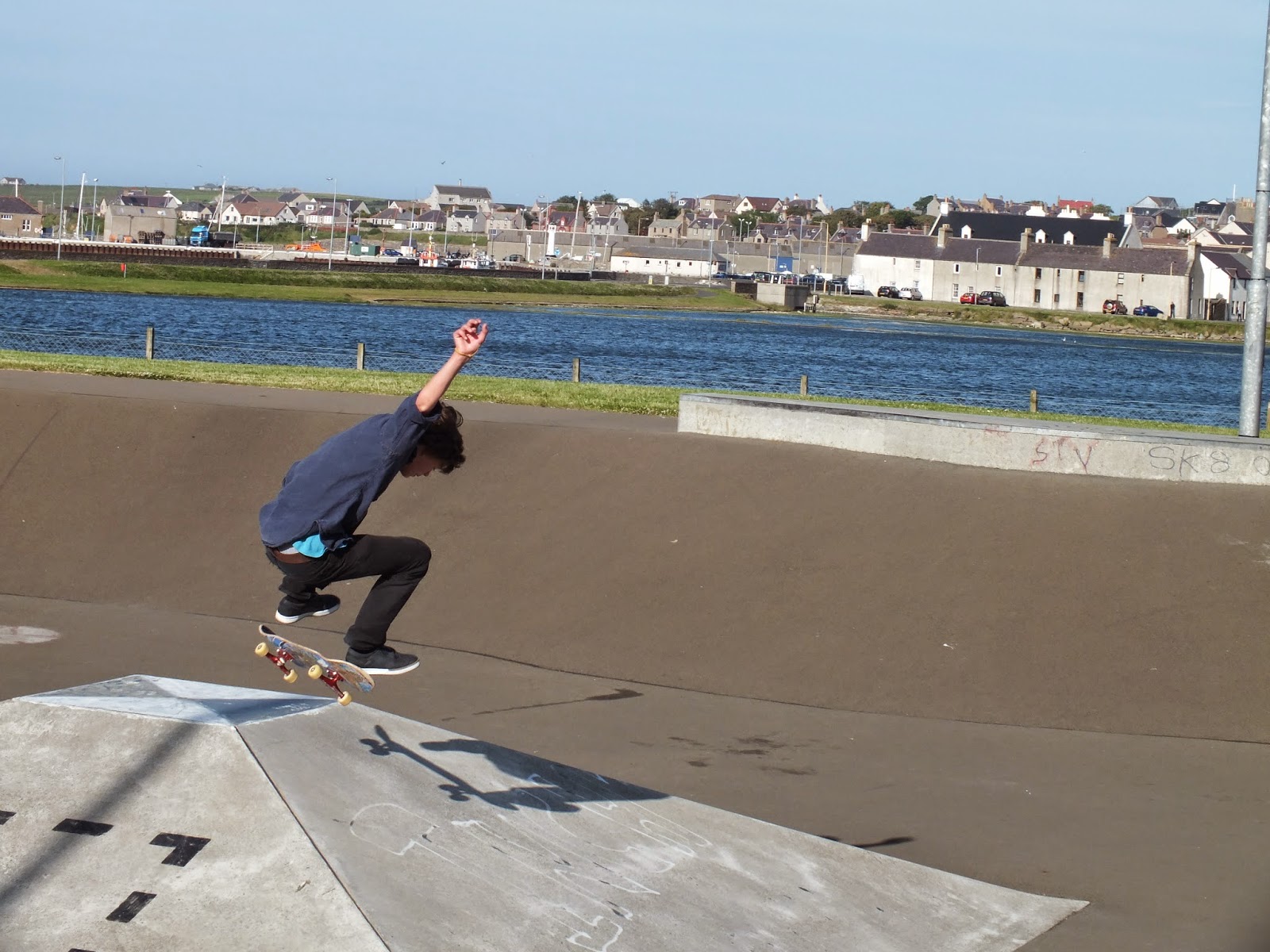
Orkney Skate Park, Kirkwall

Leaving Broch of Gurness we turn south on the main road toward Kirkwall to find a skateboarding park and a dinner location, hopefully one that serves local seafood.  The roads here are very narrow. Many of the main roads are one lane with turn outs to allow cars to navigate past one another.   Drivers must cooperate with one another here and I begin to wonder if the USA could benefit from less highway projects to add lanes and more opportunities for driver cooperation.  (Not!) We are so accustomed to getting to point B from point A quickly.  I've noticed that we are always on the go when in the car here albeit  slowly and rarely do I see stop signs or red lights, we only yield when we go through a roundabout.  Perhaps it  is all the stop lights that frustrate American drivers and leads to so much road rage.  I like the pace here but then again I am on vacation.


Kirkwall comes into view thankfully, Sam and I are tired.  I realize that if I were driving the car I would be making mistakes by now because I am confusing which side of the road we are supposed to be driving on.  We are looking for a skateboard park for Thomas that we know is in Kirkwall.  When we find it near the Tesco, we park the car and Thomas gleefully speeds toward the park, Will following with the camera.  Sam and I lay the seats back in the car and take a short cat nap.  Thomas will be able to tell his friends he has skateboarded on Orkney and will even be able to post pictures on Facebook.


Orkney Skate Park, Kirkwall

Rested, we find the Kirkwall Hotel with the restaurant on the harbor and order the usual hearty Scottish fare- steak pie with puff pastry and fresh salmon which I never tire of.  The restaurant is very comfortable and well appointed and it feels nice to sit and relax after our windswept day. Suddenly, we realize it is the 4th of July but there has been no fanfare here to let us know what day it is.  For a moment I miss home and all things USA, but only for a moment, we have had one of the most memorable days.  We drink a toast to the good ole US of A.

Kirkwall Hotel, Orkney Island, Scotland  http://www.kirkwallhotel.com/index.html


Arriving back at our lodging at Houton Bay we have a wee bedtime dram of Scotch at the bar and meet one of the locals.  Our hostess explains to us that his last name is "Grote" and he is said to be one of the descendants of the namesake "John O'Groat which is the northernmost town on the Scottish mainland.  Land's End, the southern most tip of the UK, is at the other end and tourist pride themselves in visiting both while in the British Isles.

http://en.wikipedia.org/wiki/John_o'_Groats

We chat about this as well as our the other adventures of the day. Realizing we are leaving tomorrow,  I am a bit sad.  I don't want to be leaving just yet!  Didn't I just get here?  If I had more money and time I would travel slowly, grazing my way through the region taking my time to get to know some of the local folks, breathing deeply of the landscape and the culture.  This is goodbye, for now,  I will be back.  We retire to our room to rest and pack, our ferry leaves at 11:00 tomorrow morning and we have a long drive ahead of us to Isle of Skye.

Harbor Stromness, Orkney Island, Scotland


Wednesday, November 5, 2014

Broughs and Brochs


Brough of Birsay, Orkney (low tide)
Maeshowe had been a nice respite from the wind and now we are ready to head up to the northwest tip of  the island to explore the Brough of Birsay, a small island only accessible during low tide.  We have timed our adventure just right.  The sun has finally come out making the wind more tolerable. My vantage point from the car allows me to regard the effects of the wind without my hair whipping into my eyes.  Orkney is largely agricultural and the grain crops undulate in the fields fiercely like there is a small army underneath charging toward the end of the fields  Forming a large moving patchwork blanket, the fields seems almost like a single living creature if you stand still, unfocus your eyes and stare at the horizon long enough.

Path to Brough of Birsay, Orkney

Finding the Brough of Birsay, we trek across the concrete path toward the island. Thought to have been first settled by Christian missionaries in the fifth century AD, the island  became a Pictish stronghold in the 9th century before being completely taken over by the Vikings.  The sight itself is archelogically rich for this reason.  Although the Norsemen built their dwellings on top of  and around what remained of Pictish foundations, the artifacts found show that the  Picts had operated a small forge on the island.  The most important find occured in 1935 with the discovery of the Pictish Symbol Stone, the original which now resides in a museum in Edinburgh.

Viking and Pictish ruins, Brough of Birsay, Orkney
http://www.orkneyjar.com/history/broughofbirsay/

The island itself resembles a large bowl that has been upended.  There are  cliffs of varying sizes, and a lighthouse at the top of the island.  There are no trees and the grass on the island is almost knee level and the tips are an aubergine color.  The frequent wind has tangled the tips of the grasses together into different shapes and patterns that are interesting.

Sea birds and cliffs, Brough of Birsay, Orkney


Cliffs, Brough of Birsay, Orkney


After exploring the ruins we set off up the hill an find the cliffs on the northern side of the island.  Not wanting to watch my children peer over the edge of the cliff, I tell my family that I am going to the top of the hill.  Cresting the hill I linger and enjoy the view near the lighthouse.  Small caves  and other depressions no doubt created by wind and water permeate this side of the island and I explore some of these depressions before making my way down the south side of the island.  I must have taken a long time to do all this.  At one time I wait for Sam and the boys to catch up with me but they never came.  When I finally head back to the ruins I see  my oldest son Will charging up the middle of the hill toward the lighthouse.  Waving at him he sees me and throws up his hands in a relief gesture.  Apparently, Sam and the boys had walked back to the parking lot, even driven to a nearby castle ruin looking for me.  They had really been worried that I had fallen or something.  Regrouping, we make a pact to not separate from one another again as I have the only working cell phone of the four of us.


Brough of  Birsay cliffs, Orkney
Relieved, we head to the car to visit our last site, Broch of Gurness, over on the east side of the island.  Driving through the bald undulating landscape with the windows cracked we experience the smells of crops, barnyard, and fresh windwhipped air.  We pass a small loch (Loch Swannay) that is the darkest inkiest shade of blue, the contrast against the lanscape is stunning.  Water whether it be in a loch, bay, river, ocean or even a small puddle is capable of registering so many different shades of blue, green, gray and even pink, orange and white.  I drift off on a tangent thinking of the miraculous properties of water when we turn into the car park for Broch of Gurness.

Arriving at Broch of Gurness, we are informed that the site is closed.  My search and rescue had taken up a fair amount of time.  The kindly Orcadian gentleman operating the site allows us to go ahead and have a look around anyway.  All around Scotland we have witnessed this sort of kindness.  We thank him and have a quick survey.  Broch of Gurness  is situated on Eynhallow Sound with views of other islands to the north.  A "broch" is a uniquely Scottish structure, round and of dry stone construction.  There are many examples of brochs throughout Scotland in various stages of decay and/or preservation.  It is thought they may have served a military purpose much like a castle tower or they could have simply been dwellings.  The brochs here are thought to have been built between 200-100 BC.  As with other ancient sites on Orkney it to has the Pictish/Viking past.   The story of the rediscovery of this site is interesting (see link below.)

http://www.orkneyjar.com/history/brochs/gurness/

Broch of Gurness, Orkney
Walking to the car I realize what a glorious day it has been even with all the drama on Brough of Birsay.  We will head towards Kirkwall to relax and find some dinner.

Limpets, Brough of Birsay, Orkney


Thursday, October 23, 2014

Maeshowe and Viking Graffiti


Leaving Skara Brae we do a much better job of navigating our way to Maeshowe.  Nearing our destination, we navigate a strip of land between Loch Harray and Loch Stenness which contains two significant neolithic henges, The Ring of Brodgar and The Standing Stones of Stenness.  On the left we see the Ring of Brodgar, thought to date from 2500 to 2000 BC and containing 27 stones each measuring between 7 and 15 feet in height.

The Ring of Brodgar, Orkney, Scotland
 About a mile down the road on our left we see The Standing Stones of Stenness having fewer stones but much larger ones standing up to 19 feet high.  This henge sight is thought to date from 3100 BC.   All of the sights we are seeing today are UNESCO World Heritage Sites.

http://whc.unesco.org/en/list/514

http://www.orkneyjar.com/history/brodgar/index.html

http://www.orkneyjar.com/history/standingstones/

Standing Stones of Stenness, Orkney, Scotland

We arrive at Maeshowe, an impressive neolithic burial chamber, one of the best preserved in Europe.  The site stages small group tours at an old mill converted to a gift shop across the road where we wait our turn.  Resembling no more than a large hillock from the path, it would be easy to overlook.


http://www.orkneyjar.com/history/maeshowe/chamber.htm


Path to Maeshowe, Orkney, Scotland

Entrance to Maeshowe, Orkney, Scotland

Access to the cairn is through a long low passageway and then the space opens up into a large chamber made up of many slabs of immense stone.  We were not allowed to take pictures inside but I found a picture of a postcard on the internet that shows the impressive interior.
Interior and main passageway Maeshowe, Orkney, Scotland


The only artifacts that were ever found at Maeshowe were some human skull fragments and horse bones according to our tour guide.  Norsemen sought shelter here during the 11th and 12th century and they no doubt cleared the tomb of it's contents.  One things for certain, they left behind a lot of graffiti on the carefully placed stones, in fact, this sight has one of the largest and most impressive collections of Runic inscriptions in Europe.  If you can read the Runic alphabet, you have no problem reading the inscriptions, but since none of us are experts in 12th century Nordic languages she gives us a hand with some of the translations.  They basically say things like -- "Thor was here" and "Thor is the best!"  Some of the inscriptions refer to women and are downright bawdy, much like something you would find on a bathroom wall.  Some things don't change much even after 1000 years.....  More information about the Viking graffiti is provideded in the link below.

http://www.orkneyjar.com/history/maeshowe/maeshrunes.htm


Monday, October 20, 2014

Urquhart Castle


Shoreline Firth of Moray


We had a lovely if not brief stay in Nairn.  The weather has cooperated and we have had sunshine and mild temperatures.  Hubby enjoyed his game of golf at The Nairn Golf Club and we explored the Moray Firth.  http://www.nairngolfclub.co.uk/

Teeing off at The Nairn Golf Club

"sea bacon" Moray Firth
We pack up the car and head toward Inverness on A9.  It is sizing up to be a "crackin" day.  The heather is beginning to bloom and the sheep in the fields sport their summer haircuts.  For whatever reason I get the feeling we are headed up to the lid of the world as everything feels spread out and flatter even with the mountains in the distance.  My hubby negotiates the roundabouts and I have become expert at navigating him through them saying "1/3, 1/2 or 3/4" the way around to indicate where we need to exit.  We have several roundabouts in Inverness to negotiate on our way to Loch Ness and Urquhart Castle. We head into a mountainous area on the other side of Inverness as we approach Loch Ness.  Mountain meadows, cottages, fresh air, hikers, bikers, sunshine what more could anyone want on a day like this. 

Urquhart castle was an enormous castle ruin, much larger than what I had expected.  The visitors center had a comfortable cafĂ© and shop with an interpretive center and a short film reviewing the Castle's history.  We avail ourselves of all three before going down to explore the ruins. 
http://www.urquhart-castle.co.uk/

Urquhart Castle

Loch Ness

We meet a young man dressed in a kilt at the base of the castle who works for the park service dressed in a weathered Buchanan kilt.  He tells us his mother's surname is Buchanan and then explains to us that there is a Buchanan castle near Loch Lomond, it is a ruin with no roof or windows.  Apparently, those were removed in the 1950s to avoid paying property taxes.    No, roof, no windows = no taxes hence many grand structures have been reduced to a pile of rubble due to this unfortunate tax edict.  Strangely, no Buchanan's ever lived there.  The Duke of Montrose built the castle in 1954 where the family lived until the early 1900s when it was sold to the Graham family.  It then served as a hotel and as a hospital during the war before it reach it's current state. 


I make quick mental notes to do more research on this as we head back to the car.